Test Alert
British Summer is started !
Across the Wessex area, rainfall for August was ‘above normal’ for the time of year at 157% Long-Term Average. Rainfall in the Frome catchment was ‘notably high’ in August at 180% Long Term Average. The month started dry, with rainfall concentrated in the second half of the month. 22% of the month’s rainfall fell on 27th August. (Environment Agency Water Situation Report for the Wessex Area: August 2020).
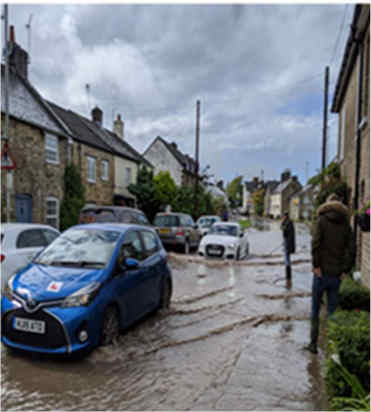
During the afternoon of 27th August 2020, heavy rainfall fell on Broadmayne and the surrounding areas. Surface water flowed from higher areas to several lower areas including Main Street, Cowleaze Road and Watergates Lane. The intensity and volume of water inundated the highway drainage system, and in Rectory Road it also resulted in surcharging of the Wessex Water public foul sewer.
Residents reported:
A total of 10 properties experienced internal flooding as a result of the flood event, the affected locations are discussed in more detail in the section about locations affected.
Based on approximate numbers reported and brought to our attention during this investigation.
| Location | Number of properties flooded internally |
Incident date | Main source(s) of flooding during incident |
|---|---|---|---|
| Main Street | 5 | 27 August 2020 | Surface water |
| Cowleaze Road | 3 | 27 August 2020 | Surface water |
| Watergates Lane | 1 | 27 August 2020 | Surface water |
| Rectory Road | 1 | 27 August 2020 | Surface water inundating the public foul sewer |
NB: It should be noted that this report is based only on the information brought to the attention of Dorset Council and reported on the FORT recording system, it does not guarantee an exact list of affected properties during this reported event.
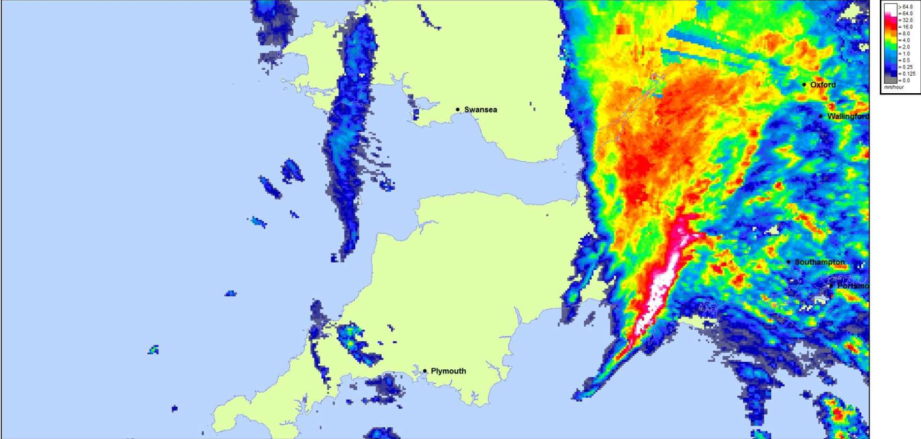
Intense rainfall was evident in Dorchester on 27th August and supported by Met Office rainfall radar data. The radar data shows that there was an intense downpour between about 3:20 and 3:35pm, with an estimated 15mm falling in 15 minutes, equating to are turn period of 1 in 9 years.
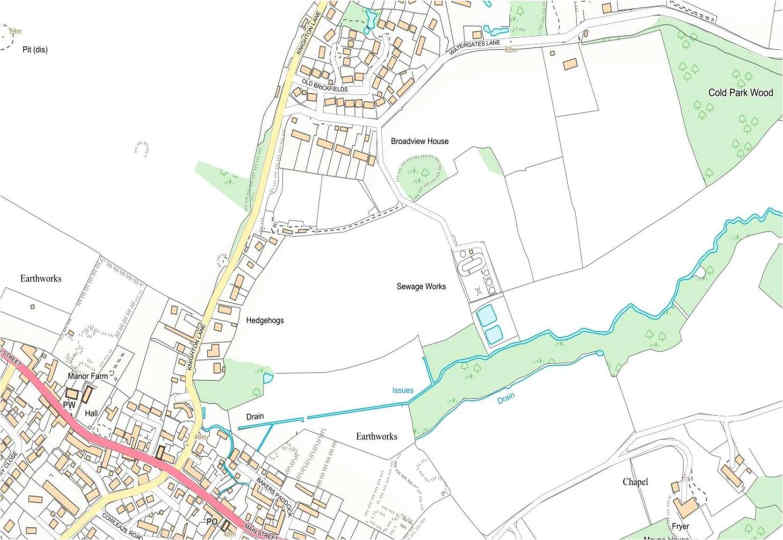
The EA maintains a network of groundwater monitoring stations across the country, which are used to monitor and inform management of groundwater resources. The nearest monitoring station is at Ashton Farm, a Water Level (Groundwater) Gauge. It is located near to the town of Martinstown or Winterborne St Martin. Broadmayne is 7.5 miles to the South east of Martinstown.
Groundwater levels at Ashton Farm increased slightly towards the end of August. Groundwater flooding was not experienced during the event of the 27th August.
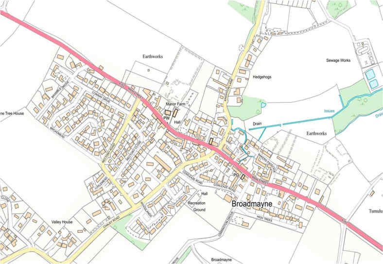
This section provides site specific information on the areas of Broadmayne affected by the flood event of the 27th August. Namely, Main Street, Cowleaze Road, Watergates Lane and Rectory Road.
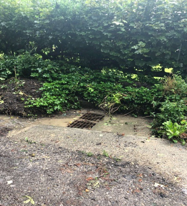
The highways drainage gullies were overwhelmed by the intensity of the rainfall event,and the capacity and effectiveness of the gullies had been further reduced by the high level of silt present in the system at the time of the event.
Pluvial surface water flowed from Osmington Drove, to the lowest area along Main Street near to the village shop. Several properties were affected due to the low threshold of their entrances, and through air vents in the front elevations.
The dropped highway kerb near to number 40 Main Street allowed surface water to mount the pathway and flow towards property, if these kerbs were to be replaced by regular kerb stones then the risk to property could be reduced. The bow waves from passing vehicles not slowing sufficiently, increased the flood risk to property.
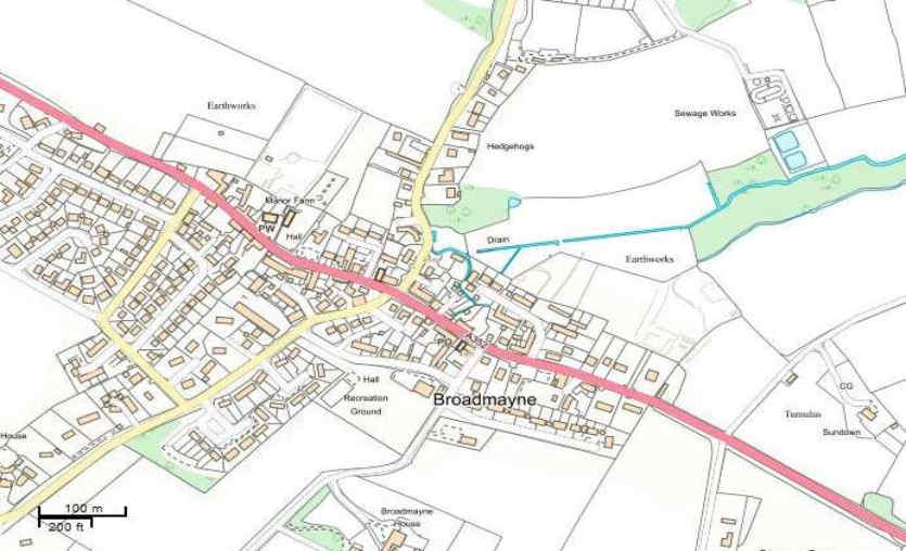
Cowleaze Road runs parallel to Main street, Pluvial surface water from Osmington Drove and High Trees flowed towards numbers 1,2 and 3 in Cowleaze Road.
The highways gullies in Cowleaze Road, High Trees and Osmington Drove were overwhelmed by the intensity of the rainfall event, overland surface water flows missed many of the highway gullies partly due to their location and the previous highway resurfacing works.
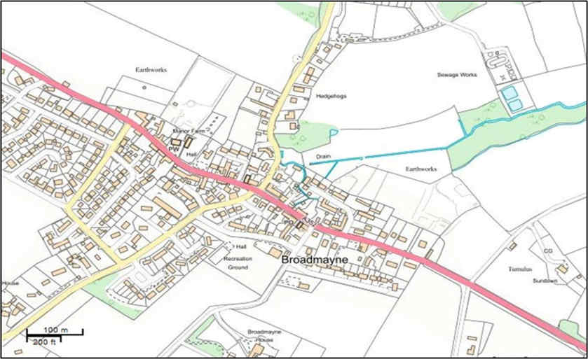
The lane has a loose stone surface and no surface water drainage. The storm on the 27th August resulted in flooding to a single property situated at the lowest level in the lane.
Rectory Lane suffered flooding as a result of a Highways drainage scheme overwhelming the Wessex Water public foul sewer. The Highways drainage connection to the public foul sewer is an historic connection and should be review following a site visit with Wessex Water.
Discuss a scheme with Dorset Highways to discharge Highways surface water elsewhere, with the aim of removing the existing discharge connection to the Wessex Water public foul sewer.